
This month, our partners at Canopy Farm Management are releasing Canopy Compass, a new web-based crop suitability mapping tool that can hopefully help us overcome one of the first barriers to agroforestry: figuring out what crops can even grow on the land we have.
Canopy Compass is probably the most comprehensive data-driven tool of its kind that’s ever been released to the public, featuring over 80 maps drawn entirely from publicly available data sources. In the latest episode of Perennial AF, host Jacob Grace talked to two of the people behind Canopy Compass, Monika Shea and Kevin Wolz, who have spent more than three years trying to get this tool ready for release.
Transcript has been edited for brevity and clarity:
Kevin Wolz
Kevin Wolz
Kevin Wolz: The number one question that we get from clients at Canopy is “can I grow X here?” It’s been very difficult to answer that question confidently and accurately for each person’s unique situation. So that’s what Canopy Compass is meant to do.
We have incredible government data bases in the US, but they’re difficult to access and sometimes not very user friendly. And it’s very easy to misinterpret or misunderstand what’s going on in there. And so we really wanted a way to take all this amazing work that the Savanna Institute has done in this realm and put it at people’s fingertips in a way that is easy, ideally fun. But we want to make sure that we’re not just throwing a bunch of data at people and saying, okay, good luck. We want to make sure that there’s proper context, support and interpretation. So Canopy Compass tries to do that: put the information at people’s fingertips and then also hold their hand along the way.
Monika Shea
Monika Shea: We’ve been working on this for a long time at the Savanna Institute. We’ve been really interested in the question of where different trees and shrubs are well-suited to grow. And one of the things we really want to do is to get that information out there for people to be able to access it and view it. We don’t really want to keep it at Savanna Institute. We want it to be usable.
This partnership between Canopy and Savanna Institute really enabled something like that to happen. Because Canopy is working with clients with a lot of the same questions, and they have resources and abilities to build this website, maintain it, continue developing it in more of a business context that makes more sense than us trying to do something like that as a nonprofit.
I would love to see people using the site and getting use from the maps. It would be wonderful. Having this information out there helps more people consider agroforestry and think about these crops on their land.
Kevin Wolz: And I’ll add, I think even more important are the situations where someone is really interested in a crop, and then Canopy Compass tells them it’s not really suitable for their location. Those are really the most important success stories: preventing crop failures.
“This Felt Really Hard” – Obstacles to Perennial Adoption for Non-Operating Landowners
Host Jacob Grace talks with his friend Alex about her family’s experiences as non-operating landowners trying to establish perennial management on their historic Wisconsin farm, and the hurdles and roadblocks they have encountered along the way.
Agroforestry for Community Food Security
Sola Gratia in Urbana, Illinois grows food for a community where one in 10 people and one in eight kids don’t know where their next meal is coming from.
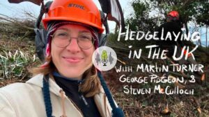
Hedgelaying in the UK with Martin Turner, George Pidgeon, and Steven McCulloch
This January, Savanna Institute staff member MJ Oviatt visited the UK to study hedgelaying with members of the Blackdown Hills Hedge Association. In this episode, we hear MJ’s recorded conversations with hedgelayers Martin Turner, George Pidgeon, and Steven McCulloch.